General Information:
The Central Korean Deciduous Forest is a regional ecosystem, part of a bigger area of land called the Northeast Asian Deciduous Forest. The winters are cold and dry with some snowfall (from December to February), and the summers are hot and wet (from June to August).
The Central Korean Deciduous Forest is a regional ecosystem, part of a bigger area of land called the Northeast Asian Deciduous Forest. The winters are cold and dry with some snowfall (from December to February), and the summers are hot and wet (from June to August).
 |
| "Map of the Korean Peninsula." Map. Intechopen.com. 12 Sept. 2011. 2 Nov. 2012 <http://www.intechopen.com> |
The map shows the exact regions of the Korean peninsula's forests.
Historical Background:
Historically speaking, this region fluctuated in vegetation to a certain extent though not by a great extent. During the early Holocene period (10,000 to 7,000 calibrated years BP), this area was a subalpine conifer forest, but the climate changed and eventually turned into a deciduous forest around the mid Holocene era. There were more oaks during this time and then it got warmer, turning the deciduous forest into a warm temperate deciduous forest, and after the mid Holocene period, the warm temperate deciduous forest just turned into a temperate deciduous forest. Around 2,000 calibrated years BP, human impact started came into effect. In the more recent years, this area had been more impacted by agriculture, from 1980's to 2000's.
 |
| Boonstra, Jan. "Chungchung Puk-do Province, South Korea." flickriver.com 13 Dec. 2010. 4 Nov. 2012.
<http://www.flickriver.com>
|
Current Human Impacts:
Much of the not-as-mountainous areas have mostly been cleared out for agriculture, but that's old news. The current stuff is more along the lines of air pollution and timber. There was more vegetation in the low-plains, but much of the low-lying plains have been taken over by for farming. Because of this, much of the deciduous forest is contained in the mountainous regions. Since deciduous forests have rich soil, people have often benefited from using the lands for agriculture though the problem of monoculture is also the negative impact it has caused this area, along with fire and pests (remember, deciduous forests are not adapted to fires). And, of course, air pollution and harvesting hardwoods for timber. Due to busy and high-tech cities in South Korea, the contribution to air pollution is rather high. However, South Korea has made attempts to reduce the impacts by investing in renewable resources; and through the help of reforestation projects, the deciduous forest remains intact though much of the ancient forests have been cut down.
Of course, in spite of all this, it seems as though deforestation seems to have continued from 1980's till the 2000's.

Why does it seem to say one thing and then say another? Well, first off, the Act on the Protection of the Baekdudaegan Mountain System was passed in 2003, which tells me that deforestation occurred more significantly during this time and the South Korean government has reacted to the assessment of human impact. The more recent data (not addressed here) deciduous forests, such as the Gwangneung Forest, which is well renowned for its reforestation program and has been named a sort of role model for other not-so-fortunate deciduous forests in the world. As indicated by the yellow color in the map above, the agricultural lands have expanded from the 1980's to the 2000's.
Here's a table of data from the 1980's and 2000's:
What can be done/Should be kept up:
While farmland can't be restored back to forests, I think that by controlling the amount of pesticides and run off gets into the ecosystem can be prevented by having less monoculture and employing more sustainable agriculture, along with polyculture (intercropping, multicropping) and agroforestry. As for timber, creating more tree plantations would reduce the clearing of forests, and by avoiding clearcutting, the trees would not be even-age. However, the most important suggestion for the Central Korean Deciduous Forest is to control the agricultural impacts because, according to the Ministry of Environment of South Korea, the deciduous forest group is under ecological conservation, particularly the white oaks. Also, the mountain range called Baekdudaegan is also protected, a large part of which is the Central Korean Deciduous Forest. On December 30, 2003, the Act on the Protection of the Baekdudaegan Mountain System was instated. This keeps most of the worrisome agricultural effects off the mountain range. Gwangneung Forest has also been protected since the 15th century.
The Future:
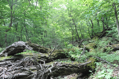
Fortunately, it seems as though the Central Korean Deciduous Forest will be safe for the most part. The demilitarized zone (as seen in the second picture) within the forest has served as a good area for wildlife, and there has been effort to protect the rarer species. Though politically, the political aspects of the DMZ is a bit complicated as the Korean Peninsula is divided by North and South. Because of this, the future for complete protection of this area is not guaranteed, and though the numbers from South Korea is publicly available, it cannot be said the same for North Korea. However, to end on a more positive note, the Ministry of Environment says the following: "...the ministry will make plans to designate DMZ area a UNESCO Biosphere Reserves and closely cooperate with UNESCO and IUCN to induce North Korea to participate in this plan." Which seems to mean that a unification of North and South might not be the sole requirement for the protection of this ecosystem.
References:
Cho, Y., Lee, C., Kim, S., & Shin, H. (2007). Dynamics and Conservation of the Gwangneung National Forest in Central Korea: A National Model for Forest Restoration. Journal of Plant Biology, 50, 615-625. http://dx.doi.org/10.1007/BF03030604
Choi, K.R., Jang, B., & Kang, S.J. (2011). Vegetation history around Yongneup moor at Mt. Daeamsan, Korea. Journal of Ecology and Field Biology, 34, 269-267. http://dx.doi.org/10.5141/JEFB.2011.028
Ministry of Environment. Ecological and Scenery Conservation Area. Retrieved from: http://eng.me.go.kr/content.do?method=moveContent&menuCode=pol_nat_sta_pre_regions
Ministry of Environment. Preservation of the Three Core Ecological Axes on the Korean Peninsula. Retrieved from: http://eng.me.go.kr/content.do?method=moveContent&menuCode=pol_nat_pol_pre_axes
Wang, Ucilia (2008). South Korea Boosts Re-newable Energy Investments by 60%. Retrieved from: http://www.greentechmedia.com/articles/read/south-korea-boosts-renewable-energy-investments-by-60-1191/
World Wildlife Fund. Eastern Asia: Central Korean Peninsula. Retrieved from: http://worldwildlife.org/ecoregions/pa0413
Yi, Sangheon (2011). Holocene Vegetation Responses to East Asian Monsoonal Changes in South Korea, Climate Change - Geophysical Foundations and Ecological Effects, Juan Blanco and Houshang Kheradmand (Ed.), ISBN: 978-953-307-419-1, InTech, Available from: http://www.intechopen.com/books/climate-change-geophysical-foundations-and-ecological-effects/holocene-vegetation-responses-to-east-asian-monsoonal-changes-in-south-korea
Image/Data:
http://eng.me.go.kr
http://www.hikekorea.com
http://www.koreabrand.net
http://www.visitkorea.or.kr
Of course, in spite of all this, it seems as though deforestation seems to have continued from 1980's till the 2000's.

Why does it seem to say one thing and then say another? Well, first off, the Act on the Protection of the Baekdudaegan Mountain System was passed in 2003, which tells me that deforestation occurred more significantly during this time and the South Korean government has reacted to the assessment of human impact. The more recent data (not addressed here) deciduous forests, such as the Gwangneung Forest, which is well renowned for its reforestation program and has been named a sort of role model for other not-so-fortunate deciduous forests in the world. As indicated by the yellow color in the map above, the agricultural lands have expanded from the 1980's to the 2000's.
Here's a table of data from the 1980's and 2000's:
|
Classification
|
1980’s
|
2000’s
|
|||
|
Area
(㎢)
|
Percentage
(%)
|
Area
(㎢)
|
Percentage (%)
|
||
|
|
Built_up
|
10.22
|
0.19
|
31.25
|
0.59
|
|
|
Agriculture
|
301.11
|
5.64
|
395.69
|
7.41
|
|
|
Forest
|
4,965.14
|
92.95
|
4,878.43
|
91.33
|
|
|
Grass land
|
47.40
|
0.89
|
21.44
|
0.40
|
|
|
Wetland
|
0.12
|
0.00
|
0.00
|
0.00
|
|
|
Barren
|
14.41
|
0.27
|
9.91
|
0.19
|
|
|
Water
|
3.28
|
0.06
|
4.95
|
0.09
|
|
Total
|
5,341.67
|
100.00
|
5,341.67
|
100.00
|
|
*data taken from: http://www.iaia.org/publicdocuments/conferencedocuments/iaia07/686.%20Song,%20Deforestation%20Patterns%20Analysis%20of%20the%20Baekdudaegan%20Mountain%20Range,%20Korea.ppt
As is notable forests have shrunk within the 20 years and the grasslands have also shrunk. The human impacts have been on the rise. However, with the Act on the Protection of the Baekdudaegan Mountain System instated, I feel that the human impact can be seen as OK and maybe even GOOD.
What can be done/Should be kept up:
 |
| Gwangneung Forest |
While farmland can't be restored back to forests, I think that by controlling the amount of pesticides and run off gets into the ecosystem can be prevented by having less monoculture and employing more sustainable agriculture, along with polyculture (intercropping, multicropping) and agroforestry. As for timber, creating more tree plantations would reduce the clearing of forests, and by avoiding clearcutting, the trees would not be even-age. However, the most important suggestion for the Central Korean Deciduous Forest is to control the agricultural impacts because, according to the Ministry of Environment of South Korea, the deciduous forest group is under ecological conservation, particularly the white oaks. Also, the mountain range called Baekdudaegan is also protected, a large part of which is the Central Korean Deciduous Forest. On December 30, 2003, the Act on the Protection of the Baekdudaegan Mountain System was instated. This keeps most of the worrisome agricultural effects off the mountain range. Gwangneung Forest has also been protected since the 15th century.
 |
| Black Woodpecker from the Gwangneung Forest |
 |
| "Baekdu-Daegan Map." Map. Hikekorea.com. 4 Nov 2012. <"http://www.hikekorea.com"> |
 |
| Part of the DMZ. |
References:
Cho, Y., Lee, C., Kim, S., & Shin, H. (2007). Dynamics and Conservation of the Gwangneung National Forest in Central Korea: A National Model for Forest Restoration. Journal of Plant Biology, 50, 615-625. http://dx.doi.org/10.1007/BF03030604
Choi, K.R., Jang, B., & Kang, S.J. (2011). Vegetation history around Yongneup moor at Mt. Daeamsan, Korea. Journal of Ecology and Field Biology, 34, 269-267. http://dx.doi.org/10.5141/JEFB.2011.028
Ministry of Environment. Ecological and Scenery Conservation Area. Retrieved from: http://eng.me.go.kr/content.do?method=moveContent&menuCode=pol_nat_sta_pre_regions
Ministry of Environment. Preservation of the Three Core Ecological Axes on the Korean Peninsula. Retrieved from: http://eng.me.go.kr/content.do?method=moveContent&menuCode=pol_nat_pol_pre_axes
Wang, Ucilia (2008). South Korea Boosts Re-newable Energy Investments by 60%. Retrieved from: http://www.greentechmedia.com/articles/read/south-korea-boosts-renewable-energy-investments-by-60-1191/
World Wildlife Fund. Eastern Asia: Central Korean Peninsula. Retrieved from: http://worldwildlife.org/ecoregions/pa0413
Yi, Sangheon (2011). Holocene Vegetation Responses to East Asian Monsoonal Changes in South Korea, Climate Change - Geophysical Foundations and Ecological Effects, Juan Blanco and Houshang Kheradmand (Ed.), ISBN: 978-953-307-419-1, InTech, Available from: http://www.intechopen.com/books/climate-change-geophysical-foundations-and-ecological-effects/holocene-vegetation-responses-to-east-asian-monsoonal-changes-in-south-korea
Image/Data:
http://eng.me.go.kr
http://www.hikekorea.com
http://www.koreabrand.net
http://www.visitkorea.or.kr